Planning outlook:
On Tuesday a band of cloud and rain moves gradually southeastwards, bringing a changeable day to northern and western areas before brighter spells and scattered showers follow. Southern and eastern England may retain dry weather for much of the day though trending cloudier, some notable falls probably reaching the southwest. Ireland sees a mixture of cloud, showers and brighter breaks. Notably cooler in Scotland and Ireland. Winds N-NE F3-F4 in the south and southwest, variable direction east of England F2-F4; W-SW F4-F5 north.
Wednesday is a fresher day. A rainy start to the day in England, the main area of rain gradually isolating to eastern areas. To the north and west, very bright with a fresh northwesterly wind pushing showers into northwest coastal areas. The showers will be frequent in west Scotland, and pass further inland through afternoon. By evening, most areas are bright with showers reaching into coastal Wales. A notably cooler day. Winds NW F4-F6, trending stronger.
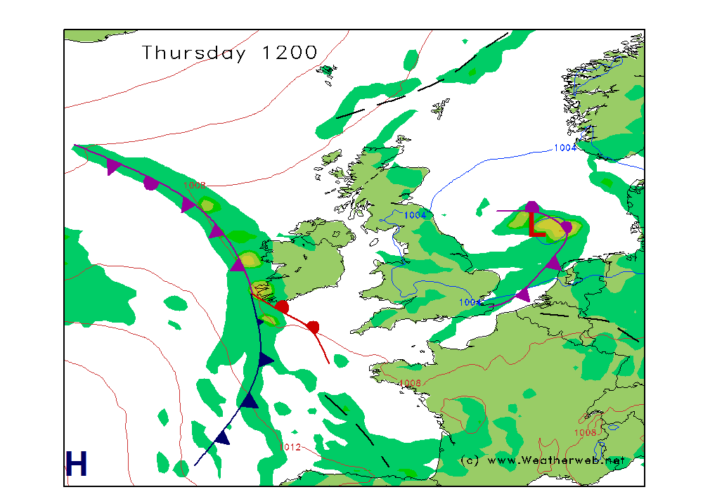
On Thursday a brisk wind pushes showers onto Britain's east coast to start the day, gradually isolating towards East Anglia and perhaps largely clearing by the end of the day. Plenty of bright weather, most cloud in northern areas exposed to coasts. Ireland is sooner cloudier, with rain arriving from the west. Staying cool. Winds start NW F4-F6, transitioning from the west when briefly lighter and variable, realigning S-SW F5-F6.
Friday brings a renewed Atlantic influence, with cloud and rain passing eastward across most areas on a strong westerly wind. Rain may be briefly heavy in many western areas, first in the north and later south. Bright spells and showers follow this main area of rain. Winds W F5-F6, or F7 north of Ireland/west Scotland.
Saturday feels fresher with scattered light showers for most, punctuated by sunny spells. Some areas of more cloud, particularly south and west. The southeast may see some early patchy rain as well. Cool in the north. Winds W F5-F7, strongest north.
Some rain and drizzle pushing into western coastal areas from dawn on Sunday, mostly dry with bright breaks to the east. Rain sweeps into Ireland and later Britain on a strong westerly breeze. Winds W-NW F4-F6.
|